
Datei:Philippines relief location map (Palawan).svg

Der Ömvang vun heh däm PNG-Minnibeldsche vun dä Ojinahl SVG-Datteij es: 377 Pixelle breed × 377 Pixelle huh. Ander Oplühsunge: 240 Pixelle breed × 240 Pixelle huh · 480 Pixelle breed × 480 Pixelle huh · 768 Pixelle breed × 768 Pixelle huh · 1024 Pixelle breed × 1024 Pixelle huh · 2048 Pixelle breed × 2048 Pixelle huh.
Ojinaal-Dattei (SVG-Datei, de Basis es 377 Pixelle breed × 377 Pixelle huh, dä Dateiömfang es 2,21 MB)
.svg)
Beschrievungstex un Zosammefassung
| Zosammefassung |
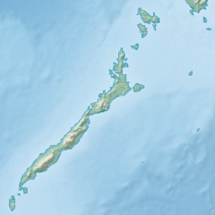
English: Physical location map of the Philippines (Palawan)
Equirectangular projection based on the parallel of 10°43' N
|
| Et Dattum | |
| Quell | File:Philippines location map (square).svg |
| Dä Urhävver | User:Hellerick |
| Ander Väsjohne |
Diese Datei wurde von diesem Werk abgeleitet: Philippines relief location map (square).svg: .svg) |
.svg)
Lizänz
He di Dattei es ze han under dä Bedengonge vun de Creative Commons ier Lizänz met „Namensnännong, un Wiggerjävve onger derselleve Bedengunge, Version 3.0, nit potteet“.
- Ühr hat de Freiheit:
- dat Werk aan Andere wigger ze jävvee – dat Werrek zu koppeere, ze verdeijle, un ze övverdraare
- et neu affzemesche – dat Werk aanzepaße udder zeräsch ze maache
- Onger dä Bedengung(e) dat:
- Namensnännong – De moß däm singe Name nänne en dä Aat, wi dää, dä et aanjevange hät, udder dää, dä de Rääschte jez hät, dat faßjelaat hät, ävver nit op en Aat, di mer esu vershtonn künnt, wi wann dää Desch, udder Dinge Jebruch, dän_De vun däm Werrek mähß, joot'heiße udder aan'äkänne dät.
- Wiggerjävve onger derselleve Bedengunge – Wann De dat Werk aanpaß, ömwandels, Der zeräsch mähß, udder drop opbouß, dann darrefs De dat, wat derbei eruß kütt, bloß onger derselleve Bedengunge, undder jannz ähnlesche Bedengunge wigger jävve, wi di Lizänz hee.
De Väsjohne vun dä Dattei
Di domohlije Version kriß De jezeich övver dä Link op em Dattum.
| Väsjohn vom | Minni-Belldsche | Pixelle Breed×Hühte (Dateiömfang) | Metmaacher | Aanmärkong | |
|---|---|---|---|---|---|
| Von jetz | 19:23, 26. Okt 2017 | | 377 × 377 (2,21 MB) | Mliu92 | User created page with UploadWizard |
Jebruch
Nix Lengk op heh di Dattei.
Jemeinsam jebruch Dateie
Heh di ander Wikis bruche di Dattei:
- Der Jebruch op ban.wikipedia.org
- Der Jebruch op bcl.wikipedia.org
- Der Jebruch op en.wikipedia.org
- Busuanga Island
- Tubbataha Reef
- Calamian Islands
- Puerto Princesa Subterranean River National Park
- Mindoro Strait
- Balabac Island
- Mangarin Bay
- Mount Mantalingajan
- Honda Bay
- Calauit Island
- Rasa Island
- Malampaya Sound
- Delian Island
- Module:Location map/data/Palawan
- Module:Location map/data/Palawan/doc
- Bacungan River
- Der Jebruch op fa.wikipedia.org
- Der Jebruch op fr.wikipedia.org
- Der Jebruch op id.wikipedia.org
- Der Jebruch op ilo.wikipedia.org
- Der Jebruch op lv.wikipedia.org
- Der Jebruch op ml.wikipedia.org
- Der Jebruch op si.wikipedia.org
- Der Jebruch op uz.wikipedia.org
.svg)