
Datei:Philippines relief location map (Mindanao).svg

Der Ömvang vun heh däm PNG-Minnibeldsche vun dä Ojinahl SVG-Datteij es: 656 Pixelle breed × 486 Pixelle huh. Ander Oplühsunge: 320 Pixelle breed × 237 Pixelle huh · 640 Pixelle breed × 474 Pixelle huh · 1024 Pixelle breed × 759 Pixelle huh · 1280 Pixelle breed × 948 Pixelle huh · 2560 Pixelle breed × 1897 Pixelle huh.
Ojinaal-Dattei (SVG-Datei, de Basis es 656 Pixelle breed × 486 Pixelle huh, dä Dateiömfang es 2,21 MB)
.svg)
Beschrievungstex un Zosammefassung
| Zosammefassung |
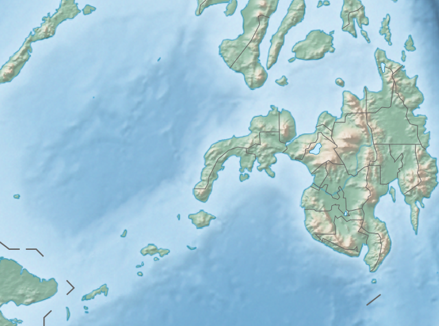
English: Physical location map of the Philippines (Mindanao)
Equirectangular projection based on the parallel of 10°43' N
|
| Et Dattum | |
| Quell | File:Philippines location map (square).svg |
| Dä Urhävver | User:Hellerick |
| Ander Väsjohne |
Diese Datei wurde von diesem Werk abgeleitet: Philippines relief location map (square).svg: .svg) |
.svg)
Lizänz
He di Dattei es ze han under dä Bedengonge vun de Creative Commons ier Lizänz met „Namensnännong, un Wiggerjävve onger derselleve Bedengunge, Version 3.0, nit potteet“.
- Ühr hat de Freiheit:
- dat Werk aan Andere wigger ze jävvee – dat Werrek zu koppeere, ze verdeijle, un ze övverdraare
- et neu affzemesche – dat Werk aanzepaße udder zeräsch ze maache
- Onger dä Bedengung(e) dat:
- Namensnännong – De moß däm singe Name nänne en dä Aat, wi dää, dä et aanjevange hät, udder dää, dä de Rääschte jez hät, dat faßjelaat hät, ävver nit op en Aat, di mer esu vershtonn künnt, wi wann dää Desch, udder Dinge Jebruch, dän_De vun däm Werrek mähß, joot'heiße udder aan'äkänne dät.
- Wiggerjävve onger derselleve Bedengunge – Wann De dat Werk aanpaß, ömwandels, Der zeräsch mähß, udder drop opbouß, dann darrefs De dat, wat derbei eruß kütt, bloß onger derselleve Bedengunge, undder jannz ähnlesche Bedengunge wigger jävve, wi di Lizänz hee.
De Väsjohne vun dä Dattei
Di domohlije Version kriß De jezeich övver dä Link op em Dattum.
| Väsjohn vom | Minni-Belldsche | Pixelle Breed×Hühte (Dateiömfang) | Metmaacher | Aanmärkong | |
|---|---|---|---|---|---|
| Von jetz | 16:36, 27. Okt 2017 | | 656 × 486 (2,21 MB) | Mliu92 | Updated crop to add missing island. |
| 19:23, 26. Okt 2017 |  | 573 × 573 (2,21 MB) | Mliu92 | User created page with UploadWizard |
Jebruch
Nix Lengk op heh di Dattei.
Jemeinsam jebruch Dateie
Heh di ander Wikis bruche di Dattei:
- Der Jebruch op bcl.wikipedia.org
- Der Jebruch op bn.wikipedia.org
- Der Jebruch op en.wikipedia.org
- Sulu Sea
- Moro Gulf
- Mount Apo
- Davao Gulf
- Iligan Bay
- Panguil Bay
- Bud Dajo
- Mount Butung
- Agusan River
- Lake Lanao
- Rio Grande de Mindanao
- Butuan Bay
- Mount Agad-Agad
- Mount Hibok-Hibok
- Mount Makaturing
- Mount Matutum
- Musuan Peak
- Agus River
- Sibuguey Bay
- Illana Bay
- Mount Sumagaya
- Dinagat Island
- Davao River
- Leonard Kniaseff
- Mount Kitanglad
- Macajalar Bay
- Pulangi River
- Cagayan River (Mindanao)
- Mount Dulang-dulang
- Tagoloan River
- Lake Buluan
- Lake Wood (Philippines)
- Lake Dapao
- Mount Malindang
- Mount Kalatungan
- Latukan
- Mount Balatukan
- Mount Hamiguitan
- Mount Baya
- Agusan Marsh Wildlife Sanctuary
- Camp General Basilio Navarro
- 2010 Mindanao earthquakes
- Manupali River
Loor donoh, woh heh di Dattei söns jebruch weed.
.svg)
.svg)