
Datei:Nouvelle-Calédonie collectivity location map centered.svg

Der Ömvang vun heh däm PNG-Minnibeldsche vun dä Ojinahl SVG-Datteij es: 784 Pixelle breed × 600 Pixelle huh. Ander Oplühsunge: 314 Pixelle breed × 240 Pixelle huh · 628 Pixelle breed × 480 Pixelle huh · 1004 Pixelle breed × 768 Pixelle huh · 1280 Pixelle breed × 979 Pixelle huh · 2560 Pixelle breed × 1958 Pixelle huh · 1017 Pixelle breed × 778 Pixelle huh.
Ojinaal-Dattei (SVG-Datei, de Basis es 1017 Pixelle breed × 778 Pixelle huh, dä Dateiömfang es 144 KB)
Beschrievungstex un Zosammefassung
| Kameraposition | | Dieses und weitere Bilder auf OpenStreetMap |
|---|
| Zosammefassung |
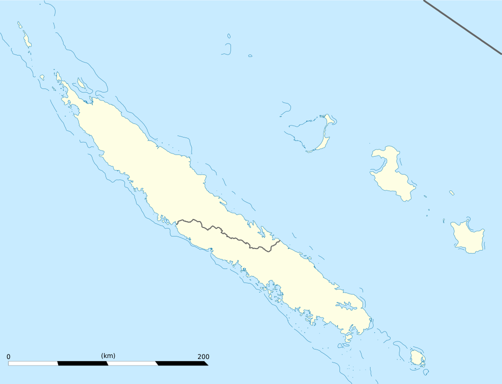
English: Blank administrative map of the territorial collectivity of New Caledonia, France, for geo-location purpose.
This is a map centered on the main islands. For a general map allowing to geo-locate the remote islands, see below. Français : Carte administrative vierge de la collectivité territoriale de Nouvelle-Calédonie, France, destinée à la géolocalisation. Ceci est une carte centrée sur les îles principales. Pour une carte générale permettant la géolocalisation des îles isolées, voir plus bas. Equirectangular projection, WGS84 datum
Geographic limits of the map:
|
||
| Et Dattum | |||
| Quell |
Eije Werk
|
||
| Dä Urhävver | Eric Gaba (Sting - fr:Sting) | ||
| Zohshtemmung (Di Dattei och anderswo bruche) |
|
||
| Ander Väsjohne |
Derivative works of this file: Drapeau Province Nord Nouvelle Calédonie.svg
|

Lizänz
Esh han et Urhävverääsch vun däm Wärk, un maachen dat Wärk öffentlesch unger dä Lizänze heh:
He di Dattei es ze han under dä Bedengonge vun de Creative Commons ier Lizänz met „Namensnännong, un Wiggerjävve onger derselleve Bedengunge, Version 3.0, nit potteet“.
- Ühr hat de Freiheit:
- dat Werk aan Andere wigger ze jävvee – dat Werrek zu koppeere, ze verdeijle, un ze övverdraare
- et neu affzemesche – dat Werk aanzepaße udder zeräsch ze maache
- Onger dä Bedengung(e) dat:
- Namensnännong – De moß däm singe Name nänne en dä Aat, wi dää, dä et aanjevange hät, udder dää, dä de Rääschte jez hät, dat faßjelaat hät, ävver nit op en Aat, di mer esu vershtonn künnt, wi wann dää Desch, udder Dinge Jebruch, dän_De vun däm Werrek mähß, joot'heiße udder aan'äkänne dät.
- Wiggerjävve onger derselleve Bedengunge – Wann De dat Werk aanpaß, ömwandels, Der zeräsch mähß, udder drop opbouß, dann darrefs De dat, wat derbei eruß kütt, bloß onger derselleve Bedengunge, undder jannz ähnlesche Bedengunge wigger jävve, wi di Lizänz hee.

|
Do darfs heh dat Dokemänt kopeere un wigger jävve un och ändere onger dä Bedenonge vun dä su jenannte GNU Free Documentation License (dä freije Lizänz för Dokemäntazjuhne vun dä GNU) en dä Version 1.2 udder ene neuere Version, wi se veröffentlesch wood vun dä Free Software Foundation (Shteftong för Frei Projramme) met kein onveränderlesch Afschnedde, keine Täx om Ömschlaach un Boochdäckel.
En Kopie vun däm Täx vun dä Lizänz es en däm Afschned onger dä Övverschreff GNU Free Documentation License. |
Do kanns Der en Lizänz ußsöhke.
De Väsjohne vun dä Dattei
Di domohlije Version kriß De jezeich övver dä Link op em Dattum.
| Väsjohn vom | Minni-Belldsche | Pixelle Breed×Hühte (Dateiömfang) | Metmaacher | Aanmärkong | |
|---|---|---|---|---|---|
| Von jetz | 21:09, 21. Jan 2009 | | 1017 × 778 (144 KB) | Sting | == Summary == {{Location|21|06|00|S|165|51|00|E|scale:2000000}} <br/> {{Information |Description={{en|Blank administrative map of the territorial collectivity of New Caledonia, France, for |
Jebruch
Nix Lengk op heh di Dattei.
Jemeinsam jebruch Dateie
Heh di ander Wikis bruche di Dattei:
- Der Jebruch op af.wikipedia.org
- Der Jebruch op als.wikipedia.org
- Der Jebruch op an.wikipedia.org
- Der Jebruch op ar.wikipedia.org
- Der Jebruch op ast.wikipedia.org
- Der Jebruch op az.wikipedia.org
- Der Jebruch op ba.wikipedia.org
- Der Jebruch op be-tarask.wikipedia.org
- Der Jebruch op be.wikipedia.org
- Der Jebruch op bg.wikipedia.org
- Der Jebruch op bn.wikipedia.org
- Der Jebruch op bs.wikipedia.org
- Der Jebruch op ceb.wikipedia.org
Loor donoh, woh heh di Dattei söns jebruch weed.