
Datei:Fiji location map.svg

Der Ömvang vun heh däm PNG-Minnibeldsche vun dä Ojinahl SVG-Datteij es: 467 Pixelle breed × 599 Pixelle huh. Ander Oplühsunge: 187 Pixelle breed × 240 Pixelle huh · 374 Pixelle breed × 480 Pixelle huh · 599 Pixelle breed × 768 Pixelle huh · 798 Pixelle breed × 1024 Pixelle huh · 1596 Pixelle breed × 2048 Pixelle huh · 728 Pixelle breed × 934 Pixelle huh.
Ojinaal-Dattei (SVG-Datei, de Basis es 728 Pixelle breed × 934 Pixelle huh, dä Dateiömfang es 144 KB)
Beschrievungstex un Zosammefassung
| Zosammefassung |
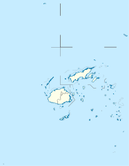
Deutsch: Positionskarte von Fidschi
Quadratische Plattkarte, N-S-Streckung 104 %. Geographische Begrenzung der Karte:
English: Location map of Fiji
Equirectangular projection, N/S stretching 104 %. Geographic limits of the map:
|
| Et Dattum | |
| Quell |
Eije Werk, using
|
| Dä Urhävver | NordNordWest |
| Zohshtemmung (Di Dattei och anderswo bruche) |
Esh han et Urhävverääsch vun däm Wärk, un maachen dat Wärk öffentlesch unger dä Lizänz heh: He di Dattei es ze han under dä Bedengonge vun de Creative Commons ier Lizänz met „Namensnännong, un Wiggerjävve onger derselleve Bedengunge, Version 3.0, nit potteet“.
|
| Ander Väsjohne |
Derivative works of this file: |


|
Diese Karte wurde in der Kartenwerkstatt erstellt oder verbessert. Auch du kannst dort Karten vorschlagen, die zu erstellen, verändern oder übersetzen sind.
|
De Väsjohne vun dä Dattei
Di domohlije Version kriß De jezeich övver dä Link op em Dattum.
| Väsjohn vom | Minni-Belldsche | Pixelle Breed×Hühte (Dateiömfang) | Metmaacher | Aanmärkong | |
|---|---|---|---|---|---|
| Von jetz | 12:19, 19. Sep 2011 | | 728 × 934 (144 KB) | NordNordWest | corr |
| 18:04, 11. Okt 2009 |  | 728 × 934 (218 KB) | NordNordWest | {{int:filedesc}} {{Information |Description= {{de|Positionskarte von Fidschi}} Quadratische Plattkarte, N-S-Streckung 104 %. Geographische Begrenzung der Karte: * N: 12.3° S * S: 21.8° S * W: 174.4° O * O: 177.9° W {{en|Location map of |
Jebruch
Nix Lengk op heh di Dattei.
Jemeinsam jebruch Dateie
Heh di ander Wikis bruche di Dattei:
- Der Jebruch op af.wikipedia.org
- Der Jebruch op an.wikipedia.org
- Der Jebruch op ar.wikipedia.org
- Der Jebruch op arz.wikipedia.org
- Der Jebruch op ast.wikipedia.org
- Der Jebruch op azb.wikipedia.org
- Der Jebruch op az.wikipedia.org
- Der Jebruch op ba.wikipedia.org
- Der Jebruch op be-tarask.wikipedia.org
- Der Jebruch op be.wikipedia.org
- Der Jebruch op bg.wikipedia.org
Loor donoh, woh heh di Dattei söns jebruch weed.